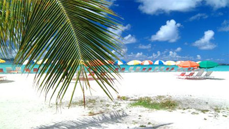
Anguilla
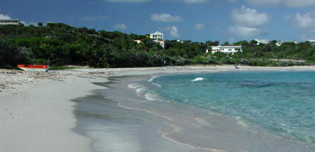
Anguilla is the most northerly of the Leeward Islands in the Eastern Caribbean, with a latitude of approximately 18 degrees north and longitude of 63 degrees west. The island
lies between the Atlantic Ocean and the Caribbean Sea, some five miles north of St. Maarten/St. Martin and one hundred fifty miles east of Puerto Rico. The territory of Anguilla comprises several offshore islets, or cays, including Sandy Island, Dog Island, Prickley Pear Cays, Scrub Island, and Sombrero Island (the location of the island's lighthouse).
Anguilla has a pleasant, healthy, tropical marine climate. The hottest months of the year are from July to October and the coolest between December and February. The mean monthly temperature is 80 degrees Fahrenheit, or 27 degrees Centigrade. The relative humidity is just over 75%.
Cooling trade winds usually sweep across the land from the east. Rainfall is low and erratic, ranging from 22 - 50 inches per year.
> View crewed yachts available in the Leeward Islands
St Martin & Sint Maarten
It's not quite as cosmopolitan as Martinique, nor is it the royalty and rock star magnet that is chic St Barts - nevertheless, with its fine French restaurants, the best duty-free shops in the Eastern Caribbean and glorious beaches, St Martin easily slips into the 'Tropez of the tropics' category.
More than a major gateway to the rest of the Eastern Caribbean, St Martin also offers visitors two countries for the price of one: St Martin takes up half the land on its island home, and the Netherlands' Sint Maarten takes up the other half, with no border controls in between.
> View crewed yachts available in the Leeward Islands
Antigua & Barbuda
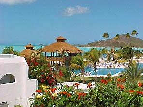
All the signs pointed towards Antigua. The island had warm, steady winds, a complex coastline of safe harbors, and a protective, nearly unbroken wall of coral reef. It would make a perfect place to hide a fleet. And so in 1784 the legendary Admiral Horatio Nelson sailed to Antigua and established Great Britain's most important Caribbean base. Little did he know that over 200 years later the same unique characteristics that attracted the Royal Navy would transform Antigua and Barbuda in one of the Caribbean's premier tourist destinations.
The signs are still there, they just point to different things. The Trade Winds that once blew British men-of-war safely into English Harbour now fuel one of the world's foremost maritime events, Sailing Week. The expansive, winding coastline that made Antigua difficult for outsiders to navigate is where today's trekkers encounter a tremendous wealth of secluded, powdery soft beaches. The coral reefs, once the bane of marauding enemy ships, now attract snorkelers and scuba divers from all over the world. And the fascinating little island of Barbuda -- once a scavenger's paradise because so many ships wrecked on its reefs -- is now home to one of the region's most significant bird sanctuaries.
Location:
Antigua (pronounced An-tee'ga) and Barbuda are located in the middle of the Leeward Islands in the Eastern Caribbean, roughly 17 degrees north of the equator. To the south are the islands of Montserrat and Guadaloupe, and to the north and west are Nevis, St. Kitts, St. Barts, and St. Martin.
Size:
Antigua, the largest of the English speaking Leeward Islands, is about 14 miles long and 11 miles wide, encompassing 108 square miles. Its highest point is Boggy Peak (1319 ft.), located in the southwestern corner of the island. Barbuda, a flat coral island with an area of only 68 square miles, lies approximately 30 miles due north. The nation also includes the tiny (0.6 square mile) uninhabited island of Redonda, now a nature preserve. The current population for the nation is approximately 68,000 and its capital is St. John's on Antigua.
Climate:
Temperatures generally range from the mid-seventies in the winter to the mid-eighties in the summer. Annual rainfall averages only 45 inches, making it the sunniest of the Eastern Caribbean Islands, and the northeast trade winds are nearly constant, flagging only in September. Low humidity year-round.
Barbuda, part of the state of Antigua, and 32 miles north is a flat, sparsely wooded coral island known as a sports-man's paradise. The island abounds in bird life and supports a population of wild pigs and fallow deer for hunting enthusiasts. It offers miles of deserted beaches, excellent fishing, snorkeling and ancient shipwrecks for underwater exploration. There are a few small inns, the best known being the Coco Point Lodge.
> View crewed yachts available in the Leeward Islands
Guadeloupe
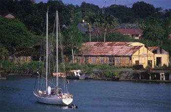
Guadeloupe is the center of the Caribbean's Creole culture, boasting a spirited blend of French and African influences. As well known for its sugar and rum as for its beaches and resorts, the archipelago offers an interesting mix of modern cities, rural hamlets, rainforests and secluded beaches.
Mainland Guadeloupe comprises two islands, Grande-Terre and Basse-Terre. Their principal city is bustling Pointe-à-Pitre at the centre of the land mass; the islands' sleepy capital, also called Basse-Terre, is on the remote southwestern side.
Guadeloupe's offshore islands to the south and west make worthwhile side excursions. The most visited, Terre-de-Haut, is a delightful place with a quaint central village and harbor, good beaches and restaurants and some reasonably priced places to stay. The other populated islands, Terre-de-Bas, Marie-Galante and La Désirade - have very little tourism development and offer visitors a glimpse of a rural French West Indies that has changed little over time.
> View crewed yachts available in the Leeward Islands
Windward Islands
At the southern end of the Caribbean chain, the Windward Islands archipelago stretches 200 Miles from St. Lucia to Grenada and is the best-kept secret in the Caribbean tourism lore. Situated as the last links before Trinidad and South America, the Windwards are lush and richly tropical volcanic islands green with palm lined sandy beaches.
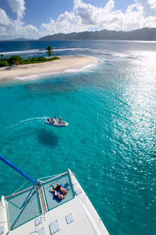
Including the magnificent St. Vincent and the Grenadines, these islands are an adventurer's dream paradise, with incredible sailing opportunities, diving on pristine and diverse reefs, walls, and shipwrecks, and fantastic island exploration hiking in rainforests, climbing majestic volcanoes, and swimming under hot-spring waterfalls. The islanders are warm and welcoming and the islands themselves are unspoiled, and safe.
The diving is outstanding, and off the beaten track of tourism. Encounters with huge schools of fish, and even big pelagic animals including dolphins and rays are commonplace. The small here is also spectacular, with seahorses, frogfish and flying gurnards regularly sighted.
> View crewed yachts available in the Grenadines
St Vincent and the Grenadines
St. Vincent and the Grenadines is a nation of many islands in the eastern Caribbean. St. Vincent is the largest and most populated island. The Grenadines consist of more than 30 small islands and hundreds of rocks, sandbars, shoals and cays (low islands made of coral). Fewer than a dozen of the Grenadine islands are populated.
The country is part of the Windward Islands chain, a series of islands that form a barrier between the Atlantic to the east and the Caribbean Sea to the west. The Windward Islands also include Grenada, St. Lucia, Dominica and the French Antilles. The islands' closest neighbors are St. Lucia to the north, Barbados to the east and Grenada to the south.
The northern third of the island of St. Vincent is mountainous. Parts of the area are accessible only by boat because roads cannot be built on the terrain. The highest peak is La Soufrière, a 1,234 metre active volcano. Its name comes from the French word soufre, which means sulphur. La Soufrière's last eruption occurred in 1979; careful planning ensured that no people were harmed.
Most of St. Vincent's interior is tropical rainforest, where banana and coconut palms grow. The forest is also home to the colorful St. Vincent parrot, the whistling warbler, the manicou (a type of opossum), and the agouti (a furry rodent). In the coastal waters, there are sea urchins, turtles and many species of fish. The sea also attracts ocean birds such as pelicans, ospreys, boobie birds and frigate birds.
Most of the island's population lives near the southern coast. Northeast of Kingstown, the Mesopotamia valley contains some of the island's most fertile farmland. North of the valley, Bonhomme, a 970-metre peak, dominates the landscape. Streams and rivers cross this land from the mountains to the sea.
The Grenadine islands are also volcanic in origin, but are smaller than St. Vincent. The largest and most developed island, Bequia (the name means "Island of the Clouds"), is only 18 square kilometers. Canouan "Island of Turtles" is known for its beautiful white beaches. Union Island is mountainous. The Tobago Cays are surrounded by coral reefs. Some islands, such as Mustique, Mayreau and Palm Island, are largely private resorts for wealthy tourists. Many of the smaller Grenadines are dry and rocky, and only a few have any freshwater sources.
Because the islands lie close to the equator, they enjoy a steady tropical temperature almost year-round. Temperatures range from 18º to 32ºC. The dry season is from December to June, and the rainy season from July to November. St. Vincent's northern peaks are often surrounded by clouds, but most of the rain falls on the mountains, leaving the southern two-thirds of the island much drier than the north. The Grenadines are also drier than northern St. Vincent. The country lies within the hurricane belt, and storms periodically damage crops and houses.
> View crewed yachts available in the Grenadines
> View a Sample Itinerary for the Grenadines
> View Grenadines Weather by Month
|